Destination guide

Trekking in Nepal

The world's premier high-altitude destination: eight-thousand-metre giants, teahouse trails, and living mountain culture.

20 min readUpdated June 13, 2026
On this page

Nepal is the world's premier high-altitude trekking destination, home to eight of the fourteen 8,000-meter peaks. Getting up close to giants like Everest or the Annapurnas is an extraordinary adventure: a sense of fulfillment and achievement you will not find anywhere else on Earth, and the peaks are only the most visible part. The trails are genuine cultural experiences, lined with ancient Buddhist monasteries, fluttering prayer flags, and sacred mani stones, so every walking day doubles as a deep immersion into the spiritual traditions of the Sherpa and Tamang.

The famous teahouse culture lets you trek far into the Himalaya without hauling heavy camping gear. These family-run lodges are a warm sanctuary where you share stories and a steaming plate of dal bhat with travelers from across the globe. And you cover an entire planet's worth of ecosystems in a single journey: start in lush subtropical jungle, climb through misty temperate forest, and finish among sunlit high glaciers. It is a vertical odyssey that shifts with every thousand meters of ascent.

When to go

Nepal's trekking calendar is governed by the summer monsoon. Autumn (September to November) is the prime window: the retreating rains leave the air clear, visibility sharp, and the weather relatively stable on routes like Everest Base Camp and the Annapurna Circuit. The trade-off is crowds on the most popular trails. Spring (March to May) is the second major window, warmer than autumn, with rhododendrons on the lower hillsides and the high-altitude expedition season underway, though afternoons cloud over and late spring brings pre-monsoon haze and growing instability.

Winter (December to February) works mainly on lower routes. High passes such as Thorong-La are frequently blocked by snow, many lodges above 4,000 m wind down, and overnight temperatures turn severe. The reward for well-equipped trekkers on lower itineraries is clear skies and empty trails. The summer monsoon (June to September) is a poor fit for most classic treks, with muddy, leech-heavy, landslide-prone trails and lost mountain views. The exception is Nepal's rain-shadow terrain, especially Upper Mustang, Upper Dolpo, and parts of upper Manang, which stay dry and are often best visited in midsummer.

Trekking conditions month by month

Jan
Feb
Mar
Apr
May
Jun
Jul
Aug
Sep
Oct
Nov
Dec
BestOkayNot recommendedAvoid
MonthConditionsNotes
JanSnow, avoidHigh passes blocked, very cold, many teahouses above 4,000 m closed.
FebSnow, not recommendedCold but improving. Lower routes viable with 4-season gear.
MarMixed, okaySpring starting. Rhododendrons below 3,500 m. Variable weather.
AprDry, bestPrime spring season. High-altitude mountaineering begins. Ramechhap diversion active for Lukla.
MayDry, bestWarm. Pre-monsoon haze in lower valleys. Late May increasingly unstable.
JunWet, not recommendedMonsoon begins. Leeches on lower trails. Exception: Mustang and Dolpo (rain shadow).
JulWet, avoidFull monsoon. Landslides and near-zero visibility. Mustang and Dolpo stay accessible.
AugWet, avoidFull monsoon continues. Mustang and Dolpo remain the exception.
SepMixed, okayMonsoon retreating. First clear windows appear. Lower trails still muddy.
OctDry, bestPrime autumn season, perfect conditions. Book lodges 2 to 3 weeks ahead on EBC and Annapurna. Ramechhap diversion active.
NovDry, bestExcellent conditions. Crowds ease after mid-month. Cold nights above 4,000 m.
DecMixed, not recommendedHigh passes closing. Many teahouses above 4,000 m close. Cold.

Most foreign nationals can still get a Tourist Visa on Arrival at Tribhuvan International Airport or select land borders. Complete the online Tourist Visa form before you travel and carry the barcode receipt; it can shorten the queue, but treat pre-arrival submission as a way to speed up VOA processing, not a full replacement for it.

Visa tiers (multiple-entry tourist visas):

  • 15 days, $30
  • 30 days, $50
  • 90 days, $125

What you need: a passport valid at least 6 months from entry, at least one blank page, and a photo upload for the online form. Carry clean USD, EUR, or GBP cash, since card terminals can fail.

Limits: tourist stays are capped at 150 days per calendar year. Extensions are handled by the Department of Immigration in Kathmandu or Pokhara, with a 15-day minimum. Children under 10 are exempt from the visa fee.

A 30-day visa covers most classic treks. Keep 15 days only for short itineraries, since weather delays can erase your buffer on Everest routes. Some nationalities (roughly 10 countries) are not eligible for VOA, so check the official list at immigration.gov.np rather than blog summaries.

Most treks in Nepal require permits, but your agency handles all of it — E-TIMS, national park and conservation area entry, and Restricted Area Permits (RAP). You just provide passport details, visa coverage, and photos if asked. You don't need to chase the paperwork.

What's worth knowing is the cost, because it's part of your quote and on restricted routes it can be one of the biggest fixed costs of the trip. RAPs in particular run into hundreds of dollars. See the table below for the going rates.

Restricted Area Permits are set and paid in USD through your agency; TIMS, ACAP, and national park entry fees are set in NPR and paid in NPR at the prevailing rate. A permit cannot be valid past the dates covered by your visa.

Permit costs by route

TIMS card (Annapurna, Langtang, Helambu, Mardi Himal)NPR 1,000 group (Blue TIMS) / NPR 2,000 FIT (Green TIMS), set by NTB and TAAN. Agency-issued as part of the package; paid in NPR.USD 8 (group) / 15 (FIT)
ACAP (Annapurna Conservation Area)NPR 3,000, set by NTNC; paired with TIMS on Annapurna and Mardi Himal. Paid in NPR.USD 22
Langtang National Park permitNPR 3,000, set by DNPWC; paired with TIMS on Langtang and Helambu. Paid in NPR.USD 22
Khumbu municipal permit + Sagarmatha National Park permitKhumbu Pasang Lhamu municipal fee NPR 2,000 (~USD 15) paid on the trail at Lukla or Monjo, plus Sagarmatha NP NPR 3,000 (~USD 22). No national TIMS in Khumbu.USD 37
Restricted Area Permit, Upper MustangFirst 10 days, then USD 50/day beyond; processed through an agency, guide mandatory. Paid in USD.USD 500
Restricted Area Permit, Upper DolpoFirst 10 days, then USD 50/day beyond; processed through an agency, guide mandatory. Paid in USD.USD 500
Restricted Area Permit, ManasluSep–Nov USD 100/week (USD 15/day beyond); Dec–Aug USD 75/week (USD 10/day beyond). Guide mandatory. Paid in USD.USD 100/week
Restricted Area Permit, Tsum ValleySep–Nov USD 40/week (USD 7/day beyond); Dec–Aug USD 30/week. Guide mandatory. Paid in USD.USD 40/week
Restricted Area Permit, Naar-PhuSep–Nov USD 100/week (USD 15/day beyond); Dec–Aug USD 75/week. Guide mandatory. Paid in USD.USD 100/week
Restricted Area Permit, KanchenjungaUSD 20/week for the first 4 weeks, USD 25/week beyond; guide mandatory. Paid in USD.USD 20/week

Once you leave a trailhead, trekking is effectively a cash economy in Nepalese Rupees (NPR). The NPR is a closed currency, so exchange or withdraw after you arrive. Kathmandu and Pokhara are the best places; airport rates are worse, so change only enough to reach the city.

City ATMs are common in Kathmandu and Pokhara, usually with per-transaction limits around NPR 35,000 to 50,000. Withdrawal fees are common, and your home bank may add its own.

On some guided treks the guide carries the working cash for transport, lodges, and basic meals included in the package; on others you still pay most of that directly. Before departure, ask the agency for a clear breakdown of what the guide pays and what stays your responsibility.

Even when the guide handles the core budget, you still need personal cash for snacks, drinks, charging, Wi-Fi, hot showers, meal supplements, tips, small souvenirs, and emergencies. Cards work in a few higher-end lodges but not reliably, and wallets like eSewa or Khalti usually need local bank integration.

Carry small notes: NPR 100 and 500 are far easier to use than NPR 1,000 or 5,000. Damaged, torn, or heavily worn banknotes are often refused on the trail. Always keep a real emergency buffer.

Transport in Nepal is part of the adventure, not a smooth transfer layer. Build patience into the trip and expect delays, rough surfaces, last-minute changes, and comfort levels that are often poor.

Kathmandu to Pokhara by road: there are tourist buses and public buses. Public buses are slower, crowded, very uncomfortable, and often completely full. Tourist buses are the better option, but the road itself is still rough. During the monsoon and just after it, the real problem is not only slowness but landslides and flooding, which can turn a routine transfer into a long, dirty, exhausting day.

Road transport to trailheads: for trailheads off the main road (Dharapani for Annapurna, Machha Khola for Manaslu, Syabrubesi for Langtang), a public bus or private 4x4 jeep is the norm. After monsoon damage, a projected 6-hour drive can easily become 10 to 12 hours or more with no warning.

The Lukla problem (Everest region): all fixed-wing flights operate under Visual Flight Rules (VFR), so cloud, fog, or crosswinds ground everything instantly. During peak spring and autumn seasons, Kathmandu to Lukla traffic is commonly shifted to Manthali Airport in Ramechhap to relieve congestion at the main Kathmandu airport. Ramechhap is a 4 to 5 hour drive east of Kathmandu, so trekkers often leave around 1 AM to reach the first flight wave at dawn. STOL baggage limits are typically strict at 15 kg total per passenger (often 10 kg checked and 5 kg hand baggage), and excess bags may be left for a later flight.

Helicopter alternative: a shared or charter heli from Kathmandu direct to Lukla is expensive but sometimes used when fixed-wing schedules collapse. It is still weather-dependent, but operators can often rework flights faster than the fixed-wing queue.

Annapurna and Langtang: road-dependent on all mainstream routes. Jomsom is the main air exception in Mustang, but the same weather logic applies there too.

Never book a tight international connection home from Kathmandu. The standard advice is 2 to 3 buffer days at the end. Missing a non-refundable international flight because of a grounded Lukla flight is one of the most common and most preventable expensive mistakes trekkers make.

Since 2023, the guide mandate has been the operative rule on most designated trekking routes. Your agency handles permits, assumes legal liability, and is your first emergency contact.

First check, TAAN membership. Before paying, verify that the agency is a member of the Trekking Agencies' Association of Nepal (TAAN). That is not a guarantee of quality, ethics, or good guide training, but it is an important minimum filter.

Guide quality varies. Top high-altitude guides hold international mountaineering certifications. Standard teahouse guides have variable English and first-aid training. Ask your agency specifically about wilderness first-aid, altitude sickness recognition, and whether the assigned person is a licensed guide rather than an unregistered freelancer.

Porters and porter-guides: a porter-guide can be a lower-cost compromise on standard teahouse routes, but verify that the arrangement satisfies the route's permit and guide requirements. The International Porter Protection Group (IPPG) sets the absolute load maximum at 30 kg. Ethical operators cap loads at 15 to 20 kg. Since each porter typically carries two trekkers' gear combined, your bag should stay under 10 to 14 kg.

Tipping: not a bonus, but a structural part of guides' and porters' seasonal income. A standard daily rate, pooled from the group, is around USD 15/day for a guide and USD 10/day for a porter. Distribute it in an envelope at the end of the trek, in NPR or USD.

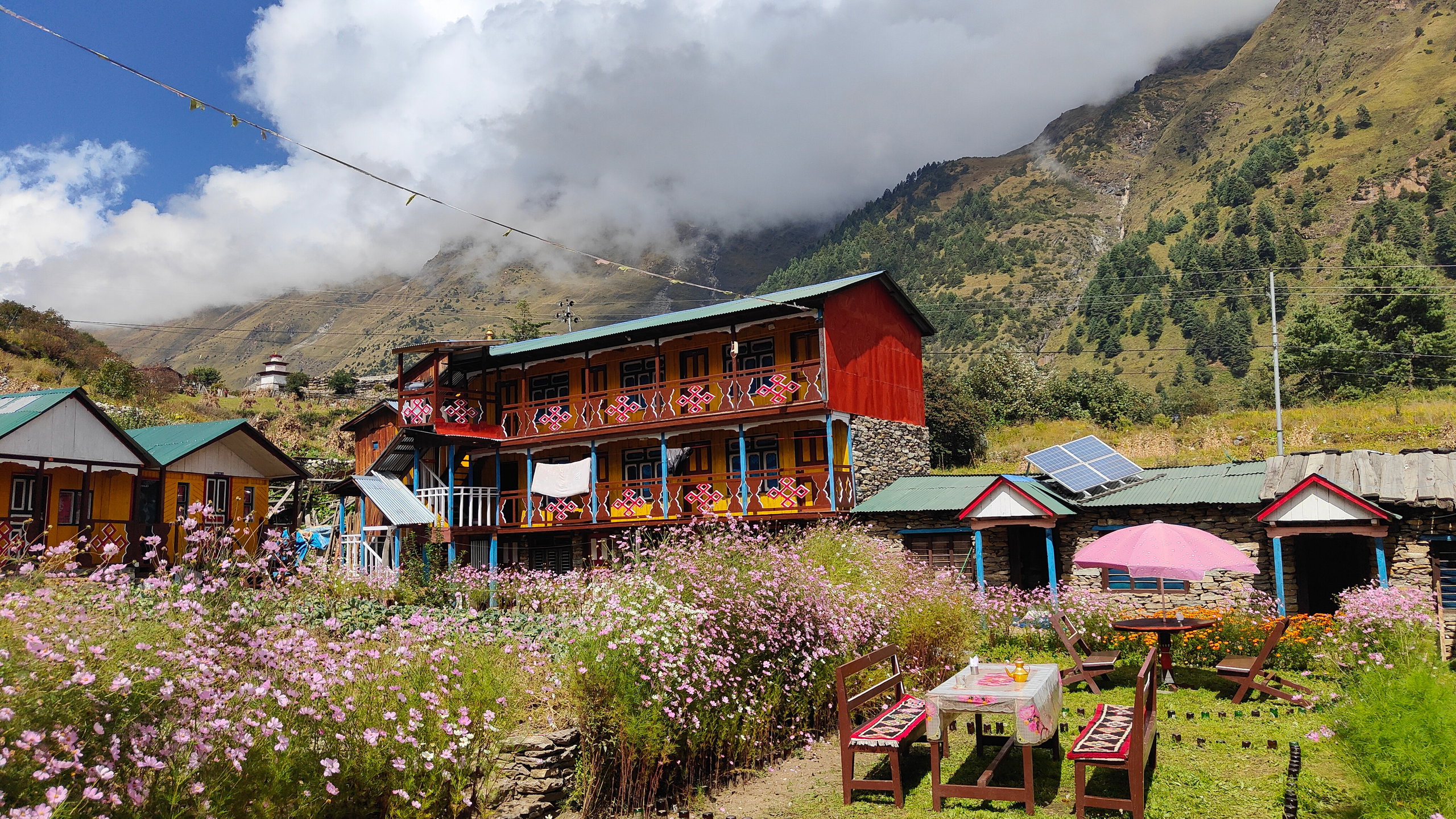
Teahouses are Nepal's mountain huts, family-run lodges with simple twin rooms and a heated communal dining hall. The bed is cheap; meals and extras are where costs accumulate.

A room is usually twin beds, thin walls, a shared toilet, and no bedroom heating. At lower elevations, some lodges have attached bathrooms, better electricity, and more solid construction. Above roughly 3,500 to 4,000 m, expect uninsulated plywood rooms and more basic communal facilities. The nightly rate is deliberately cheap (often USD 3 to 10) because the real margin is food.

The unwritten rule: sleeping at a teahouse means eating breakfast and dinner there. The dining room is the only consistently heated space, usually centered on a stove. Using that space while eating elsewhere is a serious breach of etiquette, and owners may raise the room price sharply if you do it.

Everything else costs extra: hot shower (solar or gas), phone charging, and Wi-Fi are usually separate line items, and prices rise with altitude. Budget for them instead of assuming they are included.

Sleeping bags: bedrooms are unheated. Above 4,000 m, nights drop well below 0 C. Bring a real cold-weather sleeping bag with a comfort rating around -10 C, plus earplugs for the thin walls.

In peak season (October, April) on EBC and the Annapurna Circuit, teahouses run at full capacity and trekkers have been turned away at Thorong High Camp and Gorak Shep. Your agency should book ahead; if they will not, ask why.

Teahouse menus are broader than many trekkers expect, but they are engineered around calories and easy digestion at altitude.

Dal Bhat is the default power meal. Rice, lentil soup, vegetable curry, and pickles are served almost everywhere, and free, unlimited refills make it the best calories-per-rupee option on the trail. Ordering seconds is completely normal and the staff will insist. Pasta, fried noodles, momos, potatoes, porridge, eggs, garlic soup, tea, and basic snacks are also widely available on the main routes.

Prices rise with elevation. Once road access ends, food, fuel, and drinks move uphill by porter, mule, or yak, so the same meal gets steadily more expensive as you gain altitude.

Go lighter as you go higher. Carbohydrates are generally easier to tolerate than heavy fats and meat once appetite drops at altitude. Many experienced trekkers switch to mostly vegetarian meals above 3,000 m.

Meat is the main food-safety exception. In remote teahouses there is no reliable cold chain, and meat may spend days in transit before reaching the kitchen. Above 3,000 m, the risk-to-reward ratio is poor.

Hand hygiene matters as much as menu choice. GI illness is one of the most common reasons trekkers lose days or abandon a route; sanitize before eating and after touching shared surfaces.

On water, you will usually need about 3 to 5 litres per day at altitude. Do not rely on bottled water: single-use plastic bottles are banned or restricted on most trails, prices climb fast, and the waste burden is significant. Most lodges sell boiled or filtered water by the bottle, litre, or thermos, but the daily cost adds up. A personal purification system is the best default: filter bottles are the most economical all-round choice and often pay for themselves within a few days. UV purifiers work quickly on clear water but depend on charged batteries. Chlorine dioxide tablets are the lightest option.

At altitude, the amount of air, and therefore oxygen, drops. The body can adapt, but only if you give it time. Altitude sickness does not discriminate by age or fitness, so build your itinerary around it.

Core acclimatisation rules. Above 3,000 m, do not sleep more than 300-500 m higher than the previous night. Add an acclimatisation day about every 1,000 m of gain, usually by sleeping at the same altitude for two consecutive nights. "Climb high, sleep low" day hikes are a good option.

Reading the symptoms:

  • AMS (Acute Mountain Sickness): headache, nausea, dizziness, poor sleep, unusual fatigue. Stop ascending, rest, hydrate, and do not climb higher until symptoms improve.
  • HACE: confusion, ataxia, altered mental state, hallucinations. This is an emergency. Descend immediately, even in the middle of the night.
  • HAPE: breathlessness at rest, bubbling cough, pink frothy sputum. This is an emergency. Descend immediately as well, even in the middle of the night.

AMS is a signal that your body is short of oxygen, not something to push through. Oxygen, Gamow bags, dexamethasone, and nifedipine are stabilisers only. The most effective treatment for severe altitude illness is descent.

Use your pre-trip doctor visit. You should already be seeing a doctor months before departure for vaccines and trek preparation, so use that same appointment to discuss acetazolamide (Diamox), contraindications, and your personal medical risk factors. Source: Himalayan Rescue Association.

Most trail health problems are gastrointestinal, not altitude-related. Plan ahead and most of them are avoidable.

Booking your medical appointment early matters. Some vaccine schedules need multiple doses spaced over weeks or months, so book a travel-medicine appointment several months before departure, not weeks. Hepatitis A and B, typhoid, and tetanus-diphtheria boosters are common priorities. Japanese Encephalitis is usually low-priority for classic mountain treks, while rabies is worth discussing for longer stays. Do not rely on local mountain clinics for complex medications: outposts such as the HRA clinic in Pheriche are geared toward stabilisation and assessment, not replacing your prescriptions.

GI illness is the most common trek-ending problem. Poor hand hygiene, contaminated water, and badly stored food are the usual causes. Use alcohol-based hand sanitiser before every meal and after every toilet stop. Carry oral rehydration salts and, with medical sign-off, an antibiotic such as azithromycin. If severe diarrhea or vomiting hits at altitude, descend early. Dehydration compounds altitude illness fast.

Respiratory strain is the other common problem. Above 4,000 m the air is cold, dry, and dusty. The so-called "Khumbu Cough" is a persistent dry cough caused by repeated airway irritation. A buff or balaclava over the mouth and nose helps warm and humidify inhaled air.

Teahouse hygiene is basic. High-altitude toilets are often squat toilets or unheated outhouses, toilet paper is rarely provided, and used paper usually goes in the bin rather than the bowl. Carry your own toilet paper, wet wipes, and a personal medical kit with blister care, pain relief, antiseptic wipes, anti-diarrheal medication, and your normal prescriptions.

UV protection still matters. High-altitude sun is intense even in cold weather. Use SPF 50 sunscreen daily, and above the snowline switch to proper wraparound glacier glasses to reduce the risk of snow blindness. Sources: Nepal travel information, Himalayan Rescue Association.

In Nepal's trekking regions, evacuation depends on the situation, the environment, and the weather. A helicopter is only one tool, not the default answer to every injury or altitude problem.

Typical extraction options:

  • Walk down: often the fastest answer for mild AMS, stomach issues, or manageable injuries.
  • Donkey or horse assistance: on established circuits and teahouse routes, minor orthopedic problems such as an ankle sprain can sometimes be moved out efficiently by pack animal.
  • Jeep extraction: where roads now reach the trail, a vehicle may be the practical next step once the patient is brought lower.
  • Helicopter evacuation: reserved for serious illness, severe trauma, or cases where distance and terrain make ground evacuation too slow.

Operational reality. Helicopters cannot reliably fly at night, in heavy fog, or in severe weather, so even genuine emergencies may require waiting until daylight or clearer conditions. A headache alone is not an automatic helicopter case: mild AMS is usually managed by stopping, descending, and reassessing.

Although a trek is a wonderful chance to disconnect, having a signal is reassuring, whether to send news to your family or to reach rescue services easily.

Cellular and Wi-Fi are generally fine in Kathmandu and Pokhara. For trekking, the most reliable option is NTC (Nepal Telecom, also called Namaste). Ncell is workable in cities, but for the trail NTC is the one to prioritise. Most tourist eSIMs ride on Ncell, so a local NTC SIM usually beats them on the trekking routes.

Three ways to get an NTC SIM:

  1. Tribhuvan International Airport (TIA): the easiest option. Look for the NTC counter in the arrivals hall after customs.
  2. Thamel and tourist hubs: many small shops and authorised retailers in Thamel sell SIM cards. Look for the blue "Nepal Telecom" or "Namaste" signs.
  3. NTC customer care centers: for the most official service, and especially if you need an eSIM, go to the main office in Sundhara near Dharahara Tower.

Required documents. You cannot simply buy a SIM and go. Nepal uses a formal KYC registration process. Bring your original passport, a passport photocopy, a visa photocopy or entry stamp copy, a standard passport photo, and a local address, usually just your hotel name and address in Kathmandu. Providing your thumbprints during registration is a legal requirement, part of the government's security and KYC rules to reduce fraud.

On the trail. Even with NTC, service gets weaker with altitude and terrain. In the Khumbu, Everest Link is a paid lodge-by-lodge Wi-Fi system (not blanket coverage) that can extend connectivity above the point where normal mobile data becomes unreliable, but it is still not something to depend on for real remote work. In areas with no coverage, your only reliable emergency communication may be a satellite messenger: verify your agency or guide carries one before entering remote restricted regions.

Power is limited and priced separately. Teahouse bedrooms usually do not have outlets. Charging happens in the dining room and commonly costs $2-5 per device or session, depending on the lodge. Standard plugs are Type C and Type D.

Offline navigation and battery management are mandatory. Download your route before leaving Kathmandu, keep phones in airplane mode when you do not need service (a phone left searching for weak signal drains fast), and sleep with phones and power banks inside your sleeping bag to protect battery performance in sub-zero temperatures.

Nepal's trekking routes pass through living religious landscapes shaped by both Hindu and Tibetan Buddhist traditions. Chortens, stupas, prayer wheels, and mani walls are not decorative trail features; they are active sacred objects. Walk clockwise around them, spin prayer wheels clockwise, and never sit on or step over carved mani stones.

Dress modestly in villages and around monasteries. Technical trekking clothing is fine, but cover shoulders and knees when entering religious sites or traditional settlements. Remove your shoes before entering monasteries and private homes, and follow local cues in lodges and teahouses.

Everyday etiquette matters too. Use the right hand, or both hands, when giving or receiving money, food, or documents. Avoid public displays of affection. Patience and calm are valued more than blunt confrontation, especially when service is slow or logistics go wrong. Photography needs restraint: ask before taking close portraits of people, monks, or ceremonies, and do not treat villages as open-air museums.

Regional differences are real. In the Khumbu (Sherpa, Tibetan Buddhist), animal slaughter is prohibited in the valley and vegetarianism is the respectful default. In Hindu-majority lower elevations, never enter a homestay kitchen unless you are explicitly invited. Upper Mustang, a former Tibetan kingdom, keeps distinct customs and some monasteries restrict photography.

Nepali is the national language, but the trekking regions also hold many local tongues and Tibetan-influenced dialects such as Sherpa, Gurung, and Tamang. In practice, basic English is widely usable across Nepal's trekking world, not only on Everest and Annapurna but also on routes like Manaslu and Mardi Himal. Older guides and lodge owners generally speak solid practical English, and even kids around 12 can be surprisingly comfortable in it.

The real communication drop is about geography, not age. Move farther from cities and established tourist corridors and English gets less reliable, so keep requests simple, direct, and polite. Your guide still carries permits, route changes, medical situations, and anything administrative. Keep instructions to guides, porters, drivers, and lodge staff literal: sarcasm and indirect irony rarely survive the language gap.

A few Nepali words go a long way (Namaste and Dhanyabad especially), and distances are usually given in walking hours rather than kilometers, so ask how long, not how far. Offline translation can be a good idea: download Nepali in a translation app before you leave.

Trail phrasebook

NepaliMeaning
NamasteHello / goodbye
DhanyabadThank you
Kati ho? / Kati parchha?How much?
Mitho chhaIt is delicious
BistaaraiSlowly
Do I need a licensed guide to trek in Nepal?

On the main designated routes, foreign trekkers officially need a licensed guide or registered agency, which also handles your permits. Arriving at a checkpoint without agency-issued permits can mean immediate route denial or fines, and you cannot buy permits at trailheads on restricted routes.

When is the best season to trek?

Autumn (September to November) is the prime window for stable skies and sharp views. Spring (March to May) is warmer with rhododendrons but hazier afternoons; winter suits lower routes only, and the monsoon favors rain-shadow regions like Upper Mustang and Upper Dolpo.

Is the water safe to drink?

Treat all trail water yourself: carry a filter, UV purifier, or chlorine-dioxide tablets bought before leaving Kathmandu, since bottled water is expensive and restricted on some routes. Giardia has a 1 to 3 week incubation, so if bloating or diarrhea hits after you get home, get a stool test.

How do I avoid altitude sickness?

Above 3,000 m, keep sleeping-elevation gains to 300 to 500 m and add a rest day roughly every 1,000 m; discuss acetazolamide with your doctor before the trip. HACE signs (confusion, stumbling, altered consciousness) require immediate descent regardless of hour or weather.

Related treks

Ready to put this guide to use? Start planning one of these routes.